There is no information available on Hotels in Suzhou.
Ethnic Minorities in Suzhou & Prefecture
Suzhou & City Today :
History of Suzhou:
Suzhou Climate & Weather :
Suzhou Basic Knowledge :
This page was last updated on: October 10, 2014
The Suzhou Report
Introduction to Suzhou (苏州)
Xuzhou Landmarks & Monuments
Suzhou City & Area Maps
Location : No information available
Elevation : No information available.
Surface Area: The total suface area of the
City Prefecture of Suzhou is - no information available.
Population: The Total Urban Population of Suzhou is - no information available.
The China Report
The Suzhou Report is part of the overall website www.ChinaReport.com & www.drben.net
Learn about what is new on this Site from below window.
ChinaReport.comat
A Full listing of Suzhou City Landmarks, Monuments, Hotspots and other sites of importance in alphabetical order. Search through the list to find your Full Report and Photo-Virtual Tour of each monument or landmark within the City, or Region of Suzhou in Jiangsu Province of China (PRC).
Public Transport in Suzhou
The Main and only Railway Station of Suzhou City ...
Suzhou has a Railroad Station.
There is no information available on any ethnic minority groups or members in Suzhou, at this Time.
There is no information available on the History of Suzhou.
There is no information available on modern Suzhou at this Time.
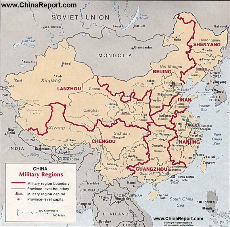
Mapshowingthe7MilitaryCommandsorDistrictsinChinaincludingtheDistrictofNanjing which lies situated centrally on the coastline of the East China Sea and theoretically includes the island Nation of Taiwan.
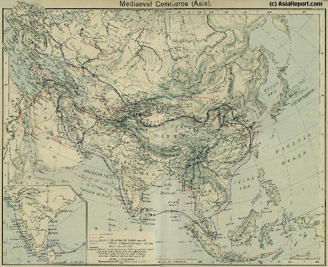
A Schematic Map of the Eurasian Trade Routes existing in the 13Th Century (Yuan Dynasty).
Clearly depicted on the Map are the land-bound trading routes through Central Asia known as the Silk Road (the path of Marco Polo and others) and the Maritime Trade Routes that operated between the Arabian Peninsula, the Indian Ocean and Coastal Cities, the Straights of Malacca and South-China Sea's. As shown Maritime Trade to China mainly entered through Southern Harbors, then was distributed internally by use of the Grand Canal, the Yangtze River and the Yellow River.
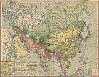
China Report - Colonialism - Growth of Colonies & Japan after 1801 AD
A Map drawing of the Eurasian continent , parts of North-East Africa and the Middle East in the 19Th Century between 1801 AD and 1900 AD. Focal points are the expansion of western colonial posessions of Portugal, Britain and France, as well as Russia moving from West to East. Labeled seperately is the later Rise of the Empire of Japan in the East.
Included in this Map are the main cities across the continent with their brief histories and events during the 19Th Century. Marked in Colors for clarity are the various colonial and imperialist Nations. As relating to China; special attention is payed to so called Treaty Ports. The First Treaty Ports were forced open by Britain in the year 1841 AD, but counted over 80 in total by the end of the 19Th Century. The most important Treaty Ports in China are marked and described with a short history where the map allows.
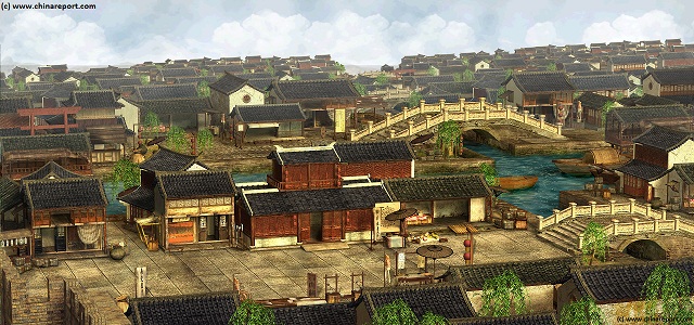
Sound Bonus: Liu Garden of Suzhou, by Oliver Shanti and Friends.